Showing 13–24 of 32 results
-

COMING SOON GIS Forecasting of Climate Change in Your Region
GIS Forecasting of Climate Change in Your Region This course focuses on a topic that affects everyone: climate change. Within this course, you will use spatial techniques to analyze and visualize the level and rate of global changes. Within this use case you will: 1) Employ ArcGIS Pro software to explore the hazards associated with…
-
Create commercial real estate development reports using GIS
Create commercial real estate development reports using GIS Learn to geo-visualize imagery and data for the $50 billion commercial property industry. GIS skills are essential in developing real estate development reports to inform investments. Real estate students, investors, and commercial brokers will be shown how to identify unique real estate parcels using online government resources….
-
Define a GIS Framework that Supports your Strategic Plan
$397.00 – $997.00Define a GIS Framework that Supports your Strategic Plan Every large organization goes through a periodic financial assessment or strategic plan which requires a ton of focus and vision for managers. And this must be done while continuing daily tasks in a shifting technology landscape. This course arms GIS/IT managers and architects with planning…
-
Design a Field Data Collection Workflow: Smartphone to GIS Dashboard
$397.00 – $997.00Design a Field Data Collection Workflow: Smartphone to GIS Dashboard Ever wonder how a local government manages millions of assets to keep your city running? A new solution is to take advantage of citizen reporting. This course shows you the new enterprise path of data maturity which goes from smartphone feature collection to citywide dashboard…
-
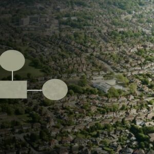
Design a geospatial workflow to plan for smart urban growth
$397.00 – $997.00Design a geospatial workflow to plan for smart urban growth The world’s population is on a trajectory to grow by 25% and reach 9.7 billion over the next 30 years. Every city in the world faces the problem of determining where people can live. You could be the urban planner or GIS analyst that needs…
-
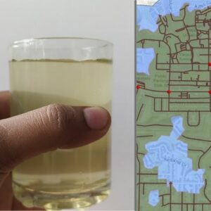
Develop a website with interactive maps to report water quality issues
$397.00 – $997.00Develop a website with interactive maps to report water quality issues In 2015, a report stated that nearly 21 million Americans were drinking water that violated health standards in the Safe Drinking Water Act. So how can we know? And how can we report suspect water? This class is for those who want to learn…
-
-
-
Learn Python / ArcServer to Setup a Property Tax Application
$397.00 – $997.00Learn Python / ArcServer to Setup a Property Tax Application A primary financial driver of cities and counties is property taxes. A central map of parcels and ownership is used by a tax assessor as well as queried by the public, commercial developers, and real estate appraisers. This course will show you how to…
-
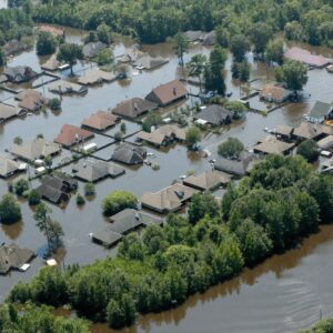
Leveraging GIS for Disaster Risk Reduction
$397.00 – $997.00Leveraging GIS for Disaster Risk Reduction Do you want to be involved with your city, county, or local Federal office planning that is in charge making your community safer? This class is for those that want to learn how GIS can proactively prepare communities for potential disasters. 455 students enrolled 4.6 KEY PARTNERS: Leveraging GIS…
-
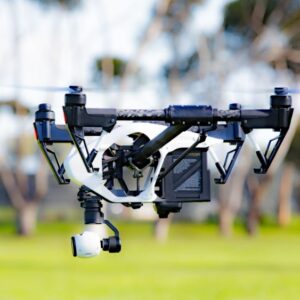
Leveraging UAV (drone) Data for Environmental Projects
$397.00 – $997.00Leveraging UAV (drone) Data for Environmental Projects Do you want to gain field data collection skills within the UAV industry that is rapidly growing to a projected $64B annual spend? This class shows you how to be the Drone/GIS expert and generate value for your environmental projects. 822 students enrolled 4.8 KEY PARTNERS:…
-
Mapping financial viability for wind farms
Mapping financial viability for wind farms Are you enthusiastic about using your GIS skills in the energy space, encouraging sustainability, and researching solutions to increasing energy demands? This course will expose you to the wind energy industry along with the GIS process of identifying suitable wind energy project locations. This includes creating wind maps, real…