The critical use of Online GIS Certificate Programs in wildfire mapping
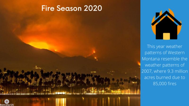
On top of all the recent events that have dominated the various news cycles around the country, we have a new problem that people need to prepare for: wildfires. As the summer heat approaches, wildfire season begins to descend upon the country, mainly in the western United States. A Chicago Tribune article predicts an above normal fire season in the Northern Rockies this year. The reason behind these fears is the weather patterns of Western Montana resembling the weather patterns of 2007, where 9.3 million acres burned due to 85,000 fires across the state.
How GIS Certification and jobs are helping
Another fear that officials have is how will COVID-19 will affect firefighting efforts. To deal with this indirect COVID-19 problem, we will be leaning on GIS Training & jobs and technology more than ever. GIS Programs analysts will be using methods such as mapped heat indexes, UAV data collection, and wildfire mapping to prepare and efficiently keep our communities and firefighters safe.
COVID-19 impact on emergency services
Coronavirus has impacted all parts of emergency services, firefighting being one of them. According to NPR, California was supposed to spend $1 billion dollars to help fight against wildfires this summer, but that money had to go into supporting efforts against COVID-19. One such program that has been affected by Coronavirus, was a State Government program that helped finance the cost of making Californian’s houses more fire resistant. In the last three years California has lost over 25,000 houses and buildings due to wildfires.