

Bo Wilmer
Contracted to:


Imtiaz Syed
Contracted to:


Nate Smith
Contracted to:


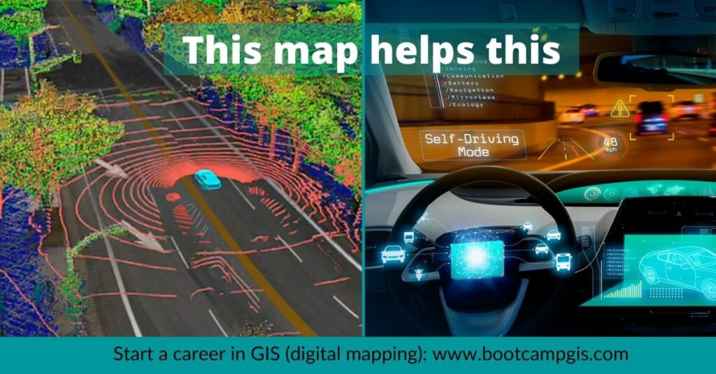
Everyone has heard of Artificial Intelligence (AI). It’s the automation of tasks based on the learning of behaviors seen in dynamic data to produce new information. The algorithms are self learning and continually discover trends. Add locational prediction and you have GeoAI.
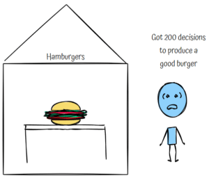
Let’s get a handle on 5 other terms that support the creation of GeoAI. We’ll use the simple example of the industry of selling hamburgers. But the same principles apply to any multivariable problem such as tracking spread of disease or reacting to climate change indicators.
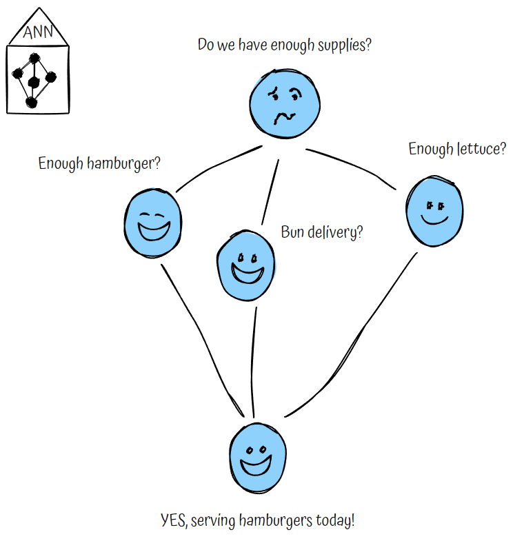
It’s a network made up of multiple nodes where each node has a function determining a simple output. This emulates the way a biological brain fires decisions in animals. The ANN is used to train an AI system on how to think quickly.
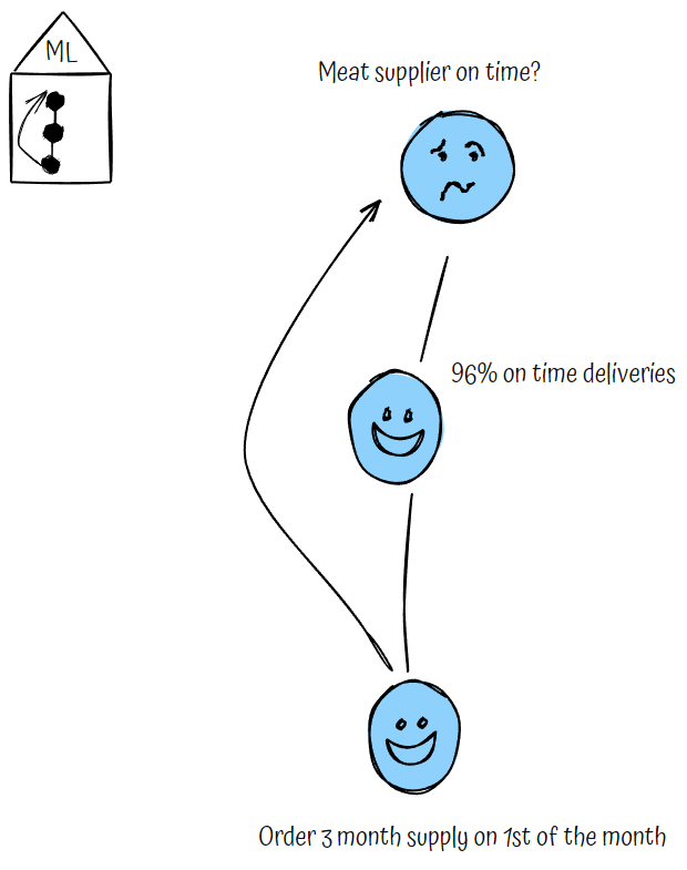
This is a model used for well-defined tasks with structured data. Outcomes teach the model to make new decisions.
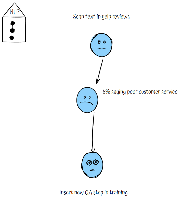
This is the machine learning technology that gives computers the ability to interpret, manipulate, and comprehend human language.
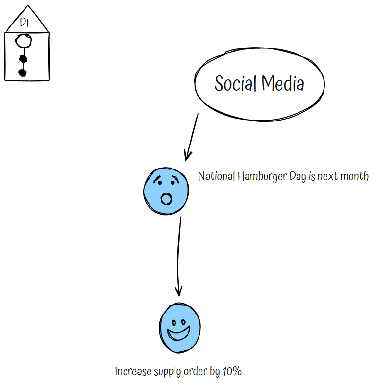
This is a type of machine learning in which multiple layers of complex tasks can make sense of unstructured data such as posts in the social media sphere.
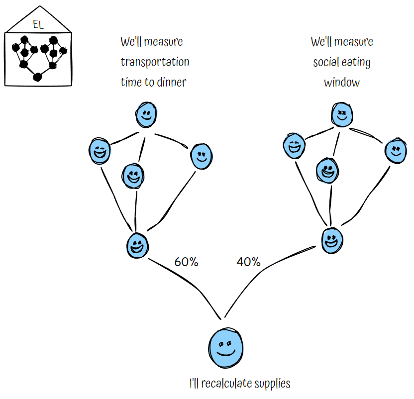
An approach in which two or more models are applied to the same data and the predictions of each model are combined.
The projection is that AI types of jobs will increase by 40% from 2023-2027. And the average salary of a machine learning engineer is $133,226 (365 DataScience report).
So now it’s time to take action with your portfolio. You might start by learning from tutorials at Esri to run some of the no-code GeoAI tools. Or you might seek a college degree that offers a class within their curriculum. Alternatively, you might want a more practical approach and learn how to create a GeoAI process in a project use-case. If you pursue this last option, you’ll be exposed to the wider tech stack that’s used in the industry.
"I want you to feel rewarded by creating actionable insights out of data. There’s an ocean of raw information out there and we need to quickly inform decision makers with the best data science to save our planet. "
Melissa Anthony, GIS/Data Science instructor
A blend of GIS and IT will teach you how to make the map system rather than just a map.
Meet targeted people to get hired with a desired company.
Show prospects that you have a focused career objective.
The world’s only GIS certificate program where industry experts teach you what they do to help you win a job in GIS.
| Cookie | Duration | Description |
|---|---|---|
| cookielawinfo-checkbox-analytics | 11 months | This cookie is set by GDPR Cookie Consent plugin. The cookie is used to store the user consent for the cookies in the category "Analytics". |
| cookielawinfo-checkbox-functional | 11 months | The cookie is set by GDPR cookie consent to record the user consent for the cookies in the category "Functional". |
| cookielawinfo-checkbox-necessary | 11 months | This cookie is set by GDPR Cookie Consent plugin. The cookies is used to store the user consent for the cookies in the category "Necessary". |
| cookielawinfo-checkbox-others | 11 months | This cookie is set by GDPR Cookie Consent plugin. The cookie is used to store the user consent for the cookies in the category "Other. |
| cookielawinfo-checkbox-performance | 11 months | This cookie is set by GDPR Cookie Consent plugin. The cookie is used to store the user consent for the cookies in the category "Performance". |
| viewed_cookie_policy | 11 months | The cookie is set by the GDPR Cookie Consent plugin and is used to store whether or not user has consented to the use of cookies. It does not store any personal data. |