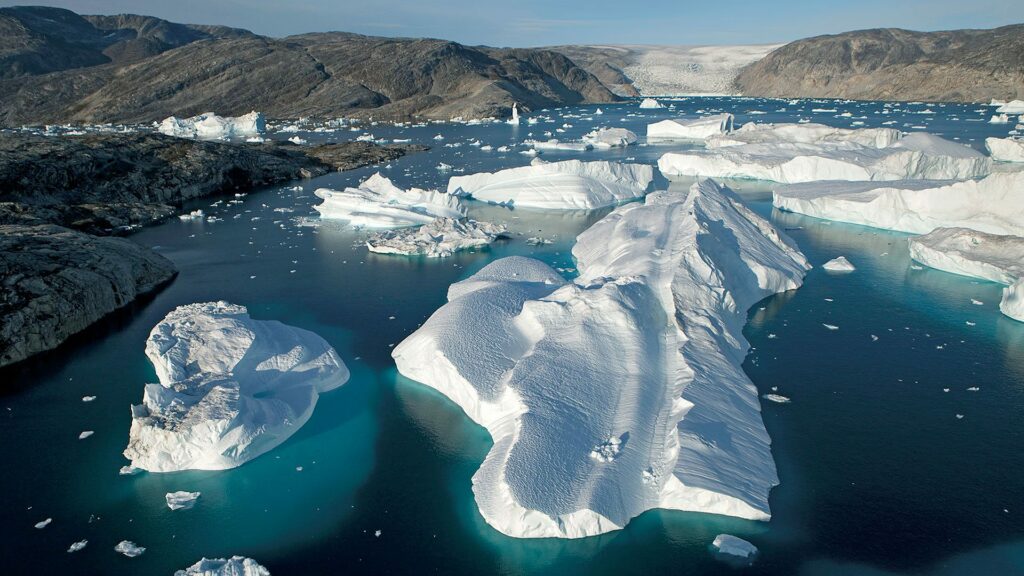
GIS Forecasting of Climate Change in Your Region
This course focuses on a topic that affects everyone: climate change. Within this course, you will use spatial techniques to analyze and visualize the level and rate of global changes. Within this use case you will: 1) Employ ArcGIS Pro software to explore the hazards associated with a changing climate, 2) Analyze and assess vulnerabilities and risk associated with climatic events, and 3) Generate geographic evidence for the presence of climate change while gaining an appreciation for using GIS as a tool to interpret the dynamic Earth. These are skills useful for organizations ranging from local cities to international earth observing programs.
KEY PARTNERS:
You’ve worked hard, but want better career results. Our program helps when…
GIS forecasting of climate change in your region
Join this class to access 10 modules showing how to map climate.
Sweating it out
(aka Intro to climate change)
Going big
(aka Big data processing)
Space time continuum
(aka Compute change over time)
Get out waders
(aka Analyze flooding)
The high water mark
(aka Analyze sea level rise)
Entrapment
(aka Analyze greenhouse gases)
Something is different
(aka Analyze landcover change)
The delta
(aka Design spatial models measuring change)
Map evidence
(aka Create cartographic layouts)
Time lapse the earth
(aka Create a time series visualization)
You also get access to these bonuses
Global data resource list
Value $79
Climate model template
Value $159
Time series method
Value $199
Enter our online GIS program anytime.
It’s a flexible program. Pick just one course or complete any 6 to earn your GIS certificate.

Focus your learning where the best GIS jobs are.
A common GIS education path has been to pursue a Masters program in GIS. But it’s widely known in the industry that new geography grads are not getting enough exposure to cloud, mobile, and new geospatial programming environments.
So we assembled a world class team to teach you how to be the talent that the geospatial industry WILL HIRE. Compare the experience of our industry instructors and you’ll see why we top the list of best online GIS certificate programs.
Pricing
Knowledge Builder
$395
Online Anytime
Professional Builder
$697
Instructor Access
Plus these exclusive features:
Certificate Builder
$997
Earn Certification
Plus these exclusive features:
Plus college certification:
Earn your GIS Certificate in 6 months with flexible choice of classes.
Take the GIS classes you want, when you want, at the price level you want.
• Knowledge builder- asynchronous learning
• Professional builder- live instructor access
• Certificate builder- college certificate in GIS

Video Demos
Narrated industry stories and software demos

Exercises
Applied tasks using data and GIS software

Instructor Access
Instructor review and feedback on deliverables

Certification
Project sign off and college certification

30 Day 100% Risk Free Guarantee
Our Promise: Purchase this course today 100% risk free. When you enroll you get 30 days of reassurance that if the course isn’t right for you, you can request a refund.
Although all our students have loved the course so far, we want to make sure you get your value for money and find our product helpful. If you wish to proceed with a refund at any point, you will need to provide proof by submitting your project to show that you completed our instructional steps as we strongly believe in this product and only want committed students who care about getting results.
What can you achieve with these new skills?
With these skills you’ll be able to create climate change products to address the most meaningful challenge of our generation
Leverage global data
Scrape and stream big data into your projects
Build spatial models
Define the functions and logic to create your models
Generate time series
Create maps and videos to illustrate climate change
Don’t settle for training that’s driven by people who don’t run projects.
When you learn from a Bootcamp GIS expert you get:
Technical experience
Industry insights
Professional network
About the Instructor

Rich Schultz has 25 years of experience as a professor in higher education and has created and developed university programs in Geospatial Technologies, Geospatial Intelligence and Location Intelligence. He has served as a co-principal investigator on National Science Grants as part of the National Geospatial Technology Center of Excellence. He brings a spatial perspective to innovate with exploration of the metaverse and blockchain technologies.
Why my course is useful
Earth observation science has given us new and scalable data sources. But there needs to be more emphasis on analyzing and reporting this data to help generate action. This course will give you some ideas to generate analysis and map products for use by the public and regional decision makers.
Why I built it
The news has been full of climate change stats and policy. And in my new education role, I have been wanting to develop a class that taught more people to take these GIS skills into environmental organizations.
What I hope for you
I want you to be informed as to some of the map products you can create to bring light to the global climate crisis. Climate study projects will be a meaningful and rewarding career landing for some of you.
GIS Forecasting of Climate Change in Your Region
Who is this class for?
The GIS industry is projected to be worth $18B by 2023. Despite this massive growth in new applications, there hasn’t been a single place for all of us to quickly learn tried and true skills from successful Subject Matter Experts (SMEs). Until Now! The people that purchase this course are:
College students and graduates looking to apply to GIS analyst jobs in the environmental sector
Environmental professionals looking to upskill and remain relevant
Top tier environmental scientists that want to learn mapping capabilities for new projects
Talk to us and we’ll figure out your best path into the industry by suggesting project managers, companies, networks, and a GIS job recruiter. It’s simply the best GIS career advisement in the world.
Top reviews from GIS forecasting of climate change in your region
I was really interested in completing projects with global implications. Learned a ton.
I liked seeing how GIS is applied to an issue that is in our regular conversations. It helped me make sense of a lot of the media coverage on climate change.
Rich was easy to talk to and provides a wide range of GIS application ideas on global issues.
I live in a coastal city and became startled at the number of issues that we’ll be wrestling with in the years to come.
This was my first course with Bootcamp GIS. Happy I selected it. It made me eager to learn more about studying global issues.