Build an ArcGIS Hub to promote environmental justice
Everyone – regardless of race, skin color, national origin, or income – has the right to the same environmental protections and benefits. One actional step towards alleviating environmental injustice, is to monitor a city’s tree canopy. Improving a city’s urban tree canopy can have numerous benefits including reducing summer peak temperatures while decreasing energy bills, decreasing air pollution, enhancing quality of life and health. This course will teach you how to use a gamut of GIS tools for collecting information from the public about trees planted, realizing the benefits of expanding a city’s urban tree canopy, and sharing those results with the public. You will gain GIS development skills using ArcGIS Pro, Survey123, Python, i-Tree API, and ArcGIS Hub for sharing information to correct an environmental justice issue in any town.
KEY PARTNERS:
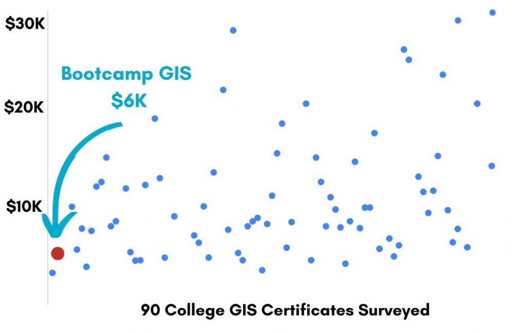
You’ve worked hard, but want better career results. Our program helps when…
Build an ArcGIS Hub to promote
environmental justice
Join this class to access 10 modules showing how to build an ArcGIS Hub.
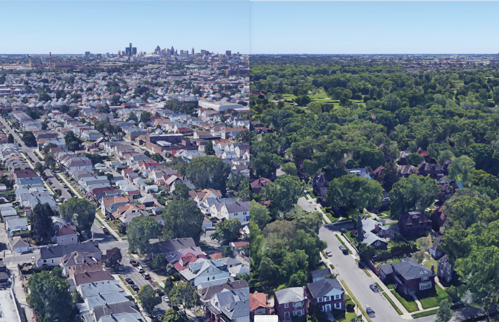
The poor need trees
(aka Tree canopy coverage)
Data miners
(aka Locate publicly available data)
Maps for all eyes
(aka Create a series of webmaps)
Trees cast shade
(aka Quantify the value of trees)
Trapping the data
(aka Create a tree feature class)
The survey form
(aka Design a tree data collection form)
Pull out the value
(aka Use Python to extract data)
The right stats
(aka Use Python to calculate fields)
Database report
(aka Use Python to automate tree reporting)
Engage the masses
(aka Configure ArcGIS Hub site)
You also get access to these bonuses
Tree feature class template
Value $79
Python script samples
Value $159
ArcGIS Hub template
Value $199
Enter our online GIS program anytime.
It’s a flexible program. Pick just one course or complete any 6 to earn your GIS certificate.
Focus your learning where the best GIS jobs are.
A common GIS education path has been to pursue a Masters program in GIS. But it’s widely known in the industry that new geography grads are not getting enough exposure to cloud, mobile, and new geospatial programming environments.
So we assembled a world class team to teach you how to be the talent that the geospatial industry WILL HIRE. Compare the experience of our industry instructors and you’ll see why we top the list of best online GIS certificate programs.
Pricing
Knowledge Builder
$395
Online Anytime
Professional Builder
$697
Instructor Access
Plus these exclusive features:
Certificate Builder
$997
Earn Certification
Plus these exclusive features:
Plus college certification:
Compare Pricing
Earn your GIS Certificate in 6 months with flexible choice of classes.
Take the GIS classes you want, when you want, at the price level you want.
• Knowledge builder- asynchronous learning
• Professional builder- live instructor access
• Certificate builder- college certificate in GIS

Video Demos
Narrated industry stories and software demos

Exercises
Applied tasks using data and GIS software

Instructor Access
Instructor review and feedback on deliverables

Certification
Project sign off and college certification

30 Day 100% Risk Free Guarantee
Our Promise: Purchase this course today 100% risk free. When you enroll you get 30 days of reassurance that if the course isn’t right for you, you can request a refund.
Although all our students have loved the course so far, we want to make sure you get your value for money and find our product helpful. If you wish to proceed with a refund at any point, you will need to provide proof by submitting your project to show that you completed our instructional steps as we strongly believe in this product and only want committed students who care about getting results.
What can you achieve with these new skills?
With these skills you’ll be able to build web apps and maps
Address environmental justice
Map where tree canopy is lacking
Write Python scripts to automate data
Use Jupyter Notebooks to write scripts
Create a community ArcGIS Hub
Share data, maps and commentary
Don’t settle for training that’s driven by people who don’t run projects.
When you learn from a Bootcamp GIS expert you get:
Technical experience
Industry insights
Professional network
About the Instructor

Pam Bond has 15 years of experience as a GIS analyst and system administrator. Although she started in wildlife biology, Pam transitioned to a full-time GIS’er after receiving her M.S. in GIS in 2011. Pam worked as a GIS Analyst for Idaho Fish and Game for seven years before taking a position with the City of Boise as a GIS administrator for four years. Currently, she is running her own GIS consulting business, Go West Geospatial Services. Pam has extensive experience using GIS (primarily Esri products) for analysis, cartography, and coding (Python, R, HTML5, CSS, and JavaScript).
Why my course is useful
When I started my GIS career, we were all making one off maps on desktop. But the evolution of web mapping has produced a need for more GIS analysts to have web developer skills. This course will show you the most common combination of web GIS skills to showcase geographic data to large audiences.
Why I built it
I can see that most college programs are lite on web developer skills. This is why many companies are forced to hire graduates with computer science degrees and then try to teach them GIS principles. I wanted to make a course that would make it easy for someone without developer skills to learn how to build web apps and customize user interfaces.
What I hope for you
I’d like people to take these skills and produce more web applications like my Urban Greenspace app. Apps like this make you pivotal to your organization as a developer and produce essential information for your community to improve the planning, equitability , and sustainability.
Build an ArcGIS Hub to promote Environmental Justice
Who is this class for?
The GIS industry is projected to be worth $18B by 2023. Despite this massive growth in new applications, there hasn’t been a single place for all of us to quickly learn tried and true skills from successful Subject Matter Experts (SMEs). Until Now! The people that purchase this course are:
College students and graduates looking to contribute to environmental justice issues
Government professionals looking to retrain themselves and remain relevant
Corporate professionals looking to maintain a competitive advantage with relevant projects.
Talk to us and we’ll figure out your best path into the industry by suggesting project managers, companies, networks, and a GIS job recruiter. It’s simply the best GIS career advisement in the world.