Coding a drought time series in Google Earth Engine
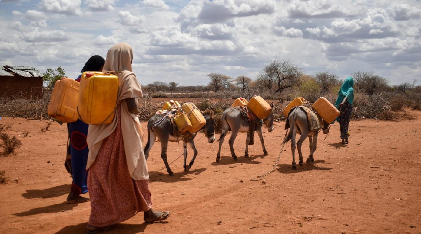
Climate change is being studied by everyone from the United Nations, to NOAA, to your local city. One of the key indicators is increasing drought. Today, 40% of the World population has suffered water scarcity. In this class you will code a machine learning workflow with Landsat imagery to describe regional drought trends. This is a GeoAI approach where we will demonstrate Google Earth Engine, Javascript coding, and machine learning models. Your final product will be a method of continued drought monitoring with statistical outputs and a timelapse video of mapped drought conditions. With these GeoAI, remote sensing, coding, and map serving skills, you can be an analyst addressing the climate change problem.
KEY PARTNERS:
You’ve worked hard, but want better career results. Our program helps when…
Coding a drought time series in
Google Earth Engine
Join this class to access 10 modules showing how to use GeoAI to assess drought.
Where’s the water?
(aka Understand drought dynamics)
View from space
(aka Identify your satellite imagery)
The logic
(aka Define your Javascript expressions)
Your target region
(aka Extract an AOI)
Image math
(aka Calculate raster algebra)
Drought index
(aka Compute landcover indices)
The exceptions
(aka Detect seasonal anomalies)
Graph it
(aka Create a linear time series chart)
Multiple opinions
(aka Write an ensemble model)
Going to the movies
(aka Create a time lapse video)
You also get access to these bonuses
Imagery list of earth observation
Value $79
Google Earth Engine publishing workflow
Value $159
Template machine learning models
Value $199
Enter our online GIS program anytime.
It’s a flexible program. Pick just one course or complete any 6 to earn your GIS certificate.
Focus your learning where the best GIS jobs are.
A common GIS education path has been to pursue a Masters program in GIS. But it’s widely known in the industry that new geography grads are not getting enough exposure to cloud, mobile, and new geospatial programming environments.
So we assembled a world class team to teach you how to be the talent that the geospatial industry WILL HIRE. Compare the experience of our industry instructors and you’ll see why we top the list of best online GIS certificate programs.
Pricing
Knowledge Builder
$395
Online Anytime
Professional Builder
$697
Instructor Access
Plus these exclusive features:
Certificate Builder
$997
Earn Certification
Plus these exclusive features:
Plus college certification:
Compare Pricing
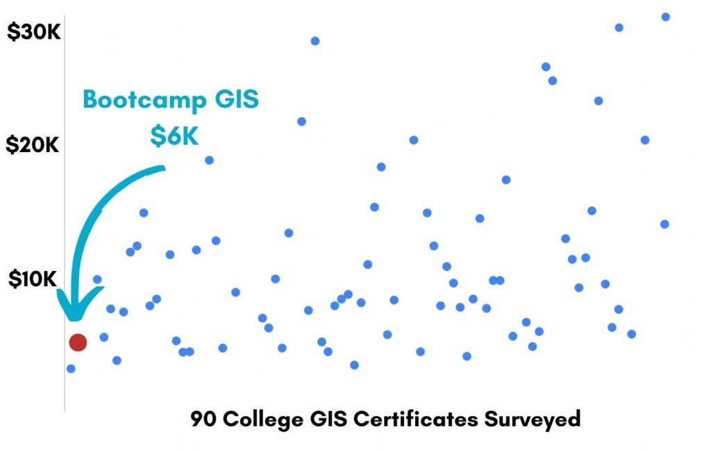
Earn your GIS Certificate in 6 months with flexible choice of classes.
Take the GIS classes you want, when you want, at the price level you want.
• Knowledge builder- asynchronous learning
• Professional builder- live instructor access
• Certificate builder- college certificate in GIS

Video Demos
Narrated industry stories and software demos

Exercises
Applied tasks using data and GIS software

Instructor Access
Instructor review and feedback on deliverables

Certification
Project sign off and college certification

30 Day 100% Risk Free Guarantee
Our Promise: Purchase this course today 100% risk free. When you enroll you get 30 days of reassurance that if the course isn’t right for you, you can request a refund.
Although all our students have loved the course so far, we want to make sure you get your value for money and find our product helpful. If you wish to proceed with a refund at any point, you will need to provide proof by submitting your project to show that you completed our instructional steps as we strongly believe in this product and only want committed students who care about getting results.
What can you achieve with these new skills?
With these skills you’ll be able to build GeoAI drought monitoring models.
GeoAI image processing
Code models in Javascript
Landcover change detection
Apply spectral indices
Visualize climate change
Generate graphs and time lapse videos
Don’t settle for training that’s driven by people who don’t run projects.
When you learn from a Bootcamp GIS expert you get:
Technical experience
Industry insights
Professional network
About the Instructor
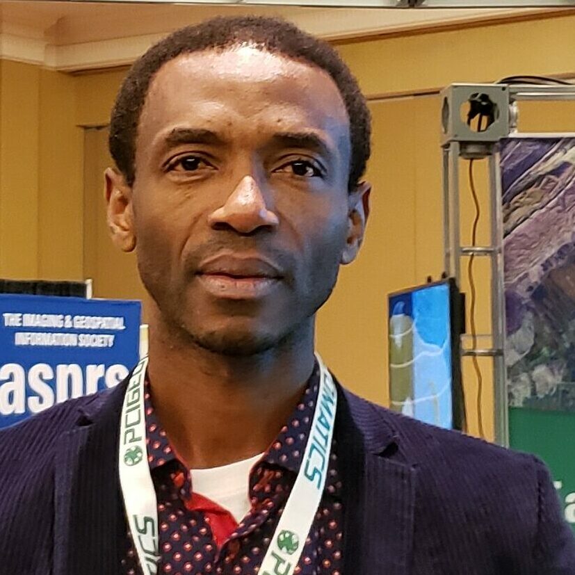
Homere ‘AL’ Ngandam has 13 years of experience in the field of Earth Observatory Sciences, with a Master of Sciences in Remote Sensing, Geographic Information Sciences, and GPS applications. He has been freelancing as a Spatial Scientist addressing key problems: urban planning for the developing world, natural hazards forecasting, and environmental monitoring. He has contributed to several national and international projects using geospatial engineering. Being from Cameroon, he is an environmental advocate and a great fan of their famous national soccer team. He loves being in the outdoors taking a walk or doing fieldwork.
Why my course is useful
We don’t have a problem of needing more data to understand problems. We have the problem of knowing how to use the plethora of existing data and tools to show geospatial trends. This course teaches you to become GeoAI literate with automating methods using earth observing imagery.
Why I built it
I’ve done a lot of fieldwork among communities that are suffering from desertification. You see hopeless eyes wherever you go. I wanted to create a class that showed skills in quantifying drought and more importantly inspired mitigating actions to help people. You’ll benefit from the workflow that a figured out and isn’t available in any university.
What I hope for you
I hope my passion for studying climate change rubs off on you and you want to pursue work with any organization that wants to mitigate the effects on people, plants and wildlife. Its easy to find meaning in a technical career that helps protect the earth for generations to come. Join me!
Coding a drought time series in
Google Earth Engine
Who is this class for?
The GIS industry is projected to be worth $200B by 2030. Despite this massive growth in new applications, there hasn’t been a single place for all of us to quickly learn tried and true skills from successful Subject Matter Experts (SMEs). Until Now! The people that purchase this course are:
College students and graduates looking for meaningful tech careers using GeoAI and machine learning
Government professionals looking to retrain themselves and remain relevant
Corporate professionals looking to maintain a competitive advantage with relevant projects.
Talk to us and we’ll figure out your best path into the industry by suggesting project managers, companies, networks, and a GIS job recruiter. It’s simply the best GIS career advisement in the world.