Develop GeoAI models for precision agriculture
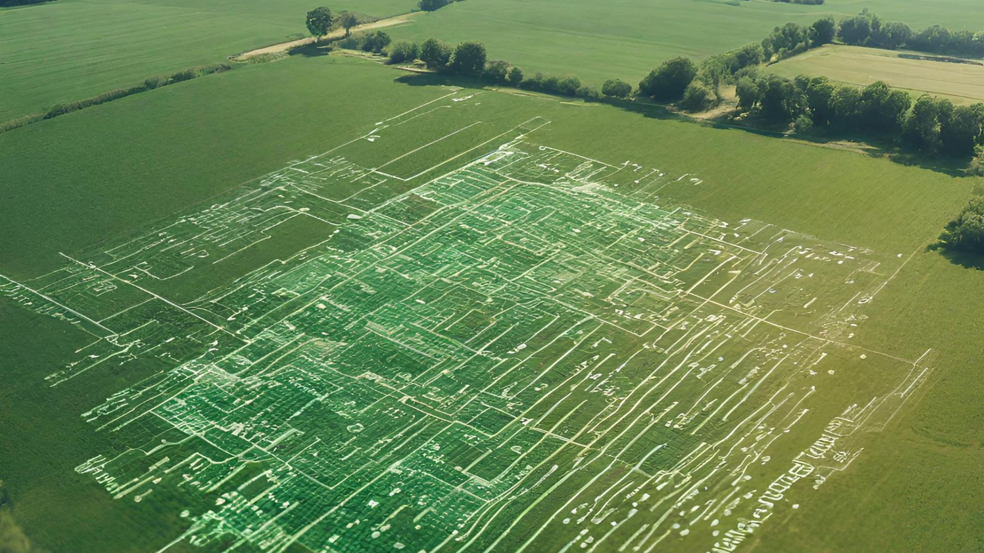
The World’s population is growing to 8.5B by 2030 and to address our food needs we will have to produce higher yields. This is a one of a kind course that will teach you the technical intricacies of leveraging GeoAI to revolutionize agricultural practices. We will equip you with the essential skills to program and deploy GeoAI models. You’ll use prominent GIS platforms and learn the power of scripting using Python and Javascript. Since these skills are cutting edge, you will be able to quickly rise up the developer ranks to assist the $3.9T agricultural industry using modern technology and approaches.
KEY PARTNERS:
You’ve worked hard, but want better career results. Our program helps when…
Develop GeoAI models for precision agriculture
Join this class to access 10 modules showing how to create GeoAI models.
AI and Maps
(aka Explain GeoAI)
Need more food
(aka Create a GeoAI model for agriculture)
Big picture
(aka Define your GeoAI project)
Did it work?
(aka Evaluate the results)
Let’s see it
(aka Visualize the insights)
It’s for everyone
(aka Share the data and findings online )
Producing more
(aka Develop a GeoAI model to measure yield)
Keep it alive
(aka Write a solution to manage crop health)
Seeing the future
(aka Write a model for predictive analytics)
We can do better
(aka Optimize crop yields)
You also get access to these bonuses
Agribusiness logistics matrix
Value $79
Web publishing workflow
Value $159
GeoAI agriculture models
Value $199
Enter our online GIS program anytime.
It’s a flexible program. Pick just one course or complete any 6 to earn your GIS certificate.
Focus your learning where the best GIS jobs are.
A common GIS education path has been to pursue a Masters program in GIS. But it’s widely known in the industry that new geography grads are not getting enough exposure to cloud, mobile, and new geospatial programming environments.
So we assembled a world class team to teach you how to be the talent that the geospatial industry WILL HIRE. Compare the experience of our industry instructors and you’ll see why we top the list of best online GIS certificate programs.
Pricing
Knowledge Builder
$395
Online Anytime
Professional Builder
$697
Instructor Access
Plus these exclusive features:
Certificate Builder
$997
Earn Certification
Plus these exclusive features:
Plus college certification:
Compare Pricing
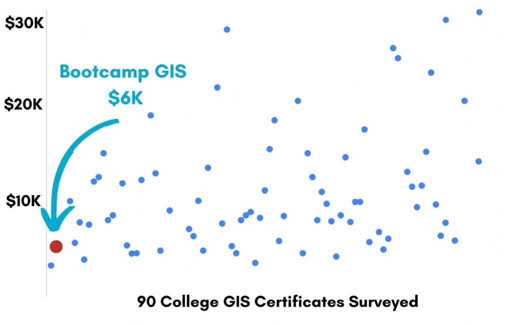
Earn your GIS Certificate in 6 months with flexible choice of classes.
Take the GIS classes you want, when you want, at the price level you want.
• Knowledge builder- asynchronous learning
• Professional builder- live instructor access
• Certificate builder- college certificate in GIS

Video Demos
Narrated industry stories and software demos

Exercises
Applied tasks using data and GIS software

Instructor Access
Instructor review and feedback on deliverables

Certification
Project sign off and college certification

30 Day 100% Risk Free Guarantee
Our Promise: Purchase this course today 100% risk free. When you enroll you get 30 days of reassurance that if the course isn’t right for you, you can request a refund.
Although all our students have loved the course so far, we want to make sure you get your value for money and find our product helpful. If you wish to proceed with a refund at any point, you will need to provide proof by submitting your project to show that you completed our instructional steps as we strongly believe in this product and only want committed students who care about getting results.
What can you achieve with these new skills?
With these skills you’ll be able to build GeoAI models for agriculture.
Learn agribusiness
Build the data to support the solution
Write a GeoAI model
Script in Python
Publish the service
Share your analysis through AGOL
Don’t settle for training that’s driven by people who don’t run projects.
When you learn from a Bootcamp GIS expert you get:
Technical experience
Industry insights
Professional network
About the Instructor

Dr. Lala El Hoummaidi has contributed her geospatial intelligence expertise for more than 12 years in service to the Dubai and Abu Dhabi Government. Currently, she serves as a GIS Unit Lead in the Environment and Protected Areas department within the Government of Alberta. She has also contributed to projects involving spatial data modeling both underground and above ground, utilizing 3D and VR technologies. Beyond her professional life, she’s passionate about sports, transitioning from a professional basketball player to doing crossfit and padel tennis.
Why my course is useful
AI is taking every industry by storm with new ways to analyze, learn, and improve decisions. But higher education has been slow to prepare students with these new skills and approaches to enter industry with a marketable profile. This course will be a huge step in bringing you up to speed with GeoAI.
Why I built it
Although I got a PhD in Water Resources Modeling, I learned my scripting, GIS, and AI skills on my own. Most people need to do this industry, but I’m proud to offer you an easier learning path to get these same skills.
What I hope for you
I want you to become the innovative force that demonstrates sustainable methods using technology. I’m positive that you can win a job from a local farm to a national department of agriculture. Just tell people ‘I know how to grow more food.’
Develop GeoAI models for
precision agriculture
Who is this class for?
The GIS industry is projected to be worth $200B by 2030. Despite this massive growth in new applications, there hasn’t been a single place for all of us to quickly learn tried and true skills from successful Subject Matter Experts (SMEs). Until Now! The people that purchase this course are:
College students and graduates looking to become marketable in the agribusiness industry
Government professionals looking to retrain themselves and remain relevant
Corporate professionals looking to maintain a competitive advantage with relevant projects.
Talk to us and we’ll figure out your best path into the industry by suggesting project managers, companies, networks, and a GIS job recruiter. It’s simply the best GIS career advisement in the world.