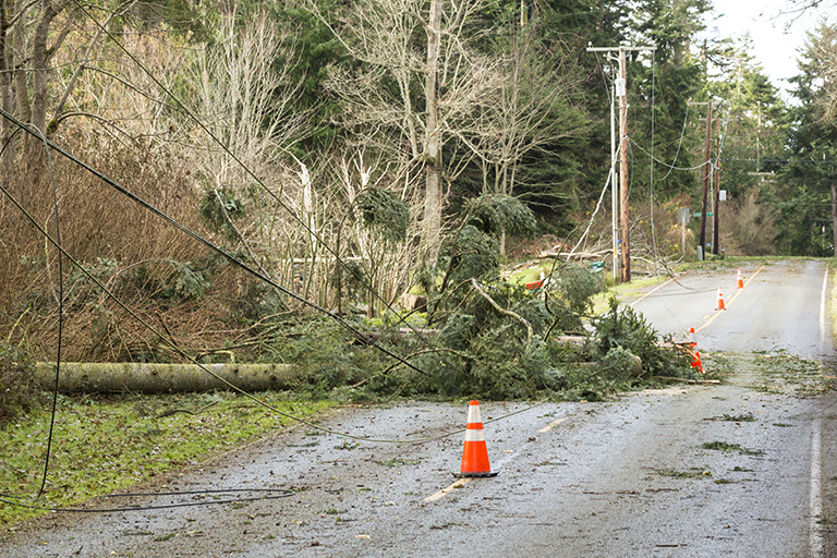
Use GIS to Support Utility Vegetation Management
Do you want to work for one of the largest GIS industries in the world? Electric utilities in the US alone spend over $100 million annually to manage vegetation. Due to rapid changing environmental conditions Utility Vegetation Management (UVM) has become a high priority. This class is for students who want learn how to leverage GIS to tackle an issue faced by every utility in the world.
186 students enrolled
KEY PARTNERS:
You’ve worked hard, but want better career results. Our program helps when…
Use GIS to Support Utility Vegetation Management
Join this class to access 10 modules showing applications in UVM.
You also get access to these bonuses
Guide: UVM Data Schema template
Value $79
Software architecture diagram
Value $159
Template Field Survey Form
Value $399
Enter our online GIS program anytime.
It’s a flexible program. Pick just one course or complete any 6 to earn your GIS certificate.
Focus your learning where the best GIS jobs are.
A common GIS education path has been to pursue a Masters program in GIS. But it’s widely known in the industry that new geography grads are not getting enough exposure to cloud, mobile, and new geospatial programming environments.
So we assembled a world class team to teach you how to be the talent that the geospatial industry WILL HIRE. Compare the experience of our industry instructors and you’ll see why we top the list of best online GIS certificate programs.
Pricing
Earn your GIS Certificate in 6 months with flexible choice of classes.
Take the GIS classes you want, when you want, at the price level you want.
• Knowledge builder- asynchronous learning
• Professional builder- live instructor access
• Certificate builder- college certificate in GIS


30 Day 100% Risk Free Guarantee
Our Promise: Purchase this course today 100% risk free. When you enroll you get 30 days of reassurance that if the course isn’t right for you, you can request a refund.
Although all our students have loved the course so far, we want to make sure you get your value for money and find our product helpful. If you wish to proceed with a refund at any point, you will need to provide proof by submitting your project to show that you completed our instructional steps as we strongly believe in this product and only want committed students who care about getting results.
What can you achieve with these new skills?
With these proven methods, you will know one of the most common program uses of GIS within any utility.
Don’t settle for training that’s driven by people who don’t run projects.
When you learn from a Bootcamp GIS expert you get:
About the Instructor

Dave Williams has over 15 years of experience in the utility and geospatial industry with a strong background in IT. Dave is the GIS Manager at the Jamaica Public Service Co., one of the largest integrated utilities in the Caribbean. During his time/journey he has worked on numerous projects leveraging the spatial power of data in an electric utility including vegetation, asset, outage management.
Why my course is useful
When a storm blows through, its typically not the wind that interrupts service. It is wind blowing vegetation into utility lines. This is an expensive problem that requires new geographic workflows before and during a storm event.
Why I built it
When I started my career in GIS, I was surprised by the lack of educational content for GIS within the electric industry. All the knowledge was with industry vendors. I built this course to support any GIS analyst who wants to see a common application in the electrical utility industry.
What I hope for you
I hope this content arms you with a stronger portfolio to more quickly enter the utility industry and enable you to hit the ground running to work in vegetation management.
Use GIS to Support Utility Vegetation Management
Who is this class for?
The GIS industry is projected to be worth $18B by 2023. Despite this massive growth in new applications, there hasn’t been a single place for all of us to quickly learn tried and true skills from successful Subject Matter Experts (SMEs). Until Now! The people that purchase this course are:
College students and graduates looking to get fast track industry insights
Government professionals looking to retrain themselves and remain relevant
Corporate professionals looking to maintain a competitive advantage with relevant projects.
Talk to us and we’ll figure out your best path into the industry by suggesting project managers, companies, networks, and a GIS job recruiter. It’s simply the best GIS career advisement in the world.
Top reviews from Use GIS To Support Utility Vegetation Management
Good course. I would recommend this to people interested in a huge issue with utitliites.
I like the workflow laid out where mapping informs work crews how to do their jobs. Its not just a paper map.
This course showed me how GIS is incredible at managing any type of issue. Storms, vegetation, loss of power.
Instructor was patient and the demos were informative and easy to follow.
The general GIS support functions were lower level than my other classes. But they were explained really well.