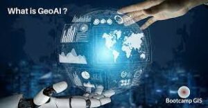
GeoAI combines geospatial data with artificial intelligence (AI) techniques. It has tremendous possibilities and applications across these fields:
1. Urban Planning:
GeoAI can aid in urban planning by analyzing geospatial data such as population density, traffic patterns, land use, and infrastructure. It can assist in determining optimal locations for new developments, identifying areas prone to hazards, and improving transportation systems.
2. Environmental Management:
GeoAI can help monitor and manage natural resources, track deforestation, analyze changes in land cover, and detect environmental risks. It enables better decision-making for conservation efforts, disaster response, and sustainable land management.
3. Agriculture and Food Security:
GeoAI can provide valuable insights for precision agriculture, optimizing crop yields, and reducing resource usage. It can analyze soil data, weather patterns, and satellite imagery to provide recommendations on irrigation, fertilizer application, and pest control.
4. Transportation and Logistics:
GeoAI can optimize expansion of transportation networks, assist with route planning, and predict traffic congestion. It can also enhance supply chain management by optimizing delivery routes, predicting demand, and improving fleet efficiency.
5. Emergency Response and Disaster Management:
GeoAI can aid in disaster preparedness, response, and recovery. It can analyze real-time data from sensors, social media, and satellite imagery to provide early warnings, assess damages, and assist in resource allocation during emergencies.
6. Healthcare and Epidemiology:
GeoAI can contribute to public health initiatives by analyzing geospatial data to identify disease hotspots, predict the spread and expansion of infectious diseases, and optimize the placement of healthcare facilities.
7. Natural Resource Exploration:
GeoAI can assist in expanding geological surveys, mineral exploration, and oil and gas prospecting. It can analyze geophysical data, satellite imagery, and historical data to identify potential resource-rich areas.
8. Smart Cities:
GeoAI can play a vital role in developing and expanding smart cities by integrating geospatial data with other IoT technologies. It can facilitate intelligent transportation systems, efficient energy management, and optimized urban services.
9. Conclusion
In conclusion, these are just a few examples of the possibilities offered by GeoAI. As AI and geospatial technologies continue to advance, the potential applications across various domains are likely to expand further. With this continuous expansion of how GeoAI can be applied. As well as its capabilities within these applications. We are further enabled to make more informed decisions and improve our understanding of the world. By combing artificial intelligence with GIS we are able to develop more mechanized and efficient ways of quantifying our solutions. Learning a skillset centered around this emergent tech is important to individuals seeking to partake in all these impactful industries.