How GeoAI will impact your job prospects
Geospatial Artificial Intelligence in the Growing Job Market
GeoAI is the term that we would use to describe artificial intelligence and geospatial machine learning. As a result, it combines geospatial data, science, and technology to address challenges in urban planning, environmental impacts, and agriculture. In 2021, as shown in figure one by Data USA, 414 students were graduating with a master’s degree in Geography, and 3,492 students graduated with bachelor’s degrees in Geography.
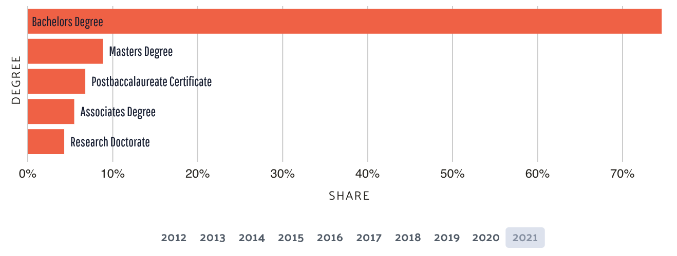
Figure 1 Data USA: Data from the Integrated Postsecondary Education Data System (IPEDS) Completions.
Most graduate students, including myself and the majority of my cohorts, did not have exposure to Geo AI courses. Leaving students deficient in these skills: API integration, designing a GIS workflow with pseudocode, Python scripting, and R statistical modeling. This article explores how training in GeoAI impacts job prospects such as students or individuals in the workforce seeking to modernize GIS skills.
Emerging Geospatial AI Job Roles
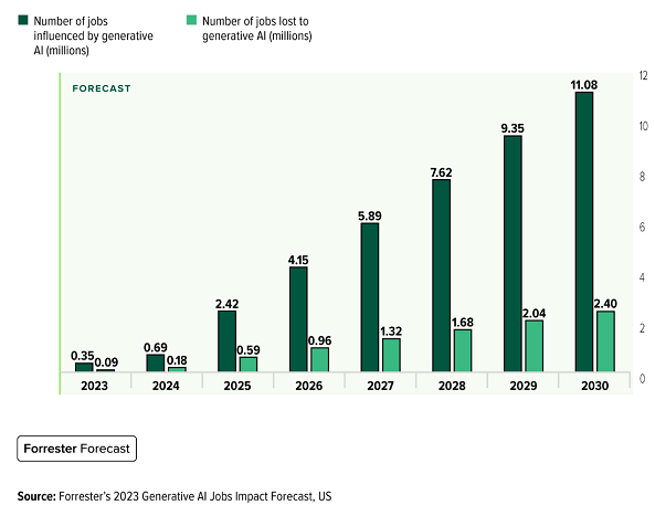
Is Artificial Intelligence GIS going to take your job? Amanda Russo from the World Economic Forum stated that AI will cause the loss of 85 million jobs by 2025 while simultaneously creating 97 million jobs.
The key is to actively acquire skills in the right group. To be competitive for these new jobs, you’ll need to acquire these developer skills: data analysis, artificial intelligence model scripting, and cloud computing (Russo, 2020). Furthermore, according to Ian Shine, another important job that will be popular is trainers. These individuals are typically engineers and scientists who design language models. The trainers job is to make AI friendly so that people can interact with AI (Shine, 2023).
Types of Problems GeoAI is Solving
Having new GeoAI skills to analyze data in real-time to make well-informed decisions is crucial in this field. Barbara Whitaker digs deep into the importance of analyzing data. She cites Rob Glazier, a GIS manager, who uses GeoAI to analyze geographic data to see where the company should put pharmacies in clinics. “GIS is our primary tool for analyzing complicated business questions” (Whitaker, 2007). Other skills skills you should seek include the ability to organize, extract, identify patterns, and make changes in big data according to Esri. With the skills in GIS AI, we can address natural disasters and emergency response. Emergency management professionals possess the skills to actively assist communities in preparation and recovery. From tracking and predicting disasters to assisting in rescue, GIS mitigates risk and damages and saves lives.
Emergence of GeoAI in Remote Sensing
Remote sensing is the science of collecting and interpreting data about the Earth’s surface from airborne or satellite sensors. Geo AI actively engages in feature recognition in images and time series classification of land cover. This active application is essential for monitoring climate change and prioritizing environmental conservation efforts. Prospects with remote sensing and mapping AI skills such as image interpretation, classification, and change detection allow you to analyze information from remotely sensed data. A project showcasing this comes from a new NASA project that enables researchers to calculate how much carbon-protected areas worldwide are storing. The scientists use satellite data to monitor forest benefits, preventing deforestation and reducing fossil fuel emissions (Abraham & Andreoni, 2023).
Skill Development and GeoAI Certificates
We’ve attended several national conferences and have seen that more than 50% of the presentations have referred to how AI will alter their business. So we advise any geospatial professionals to race to learn GeoAI skills. Bootcamp GIS courses are the most practical way to add these skills to your portfolio.
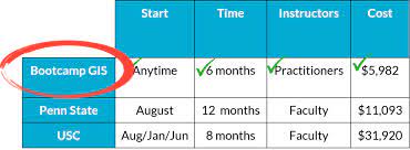
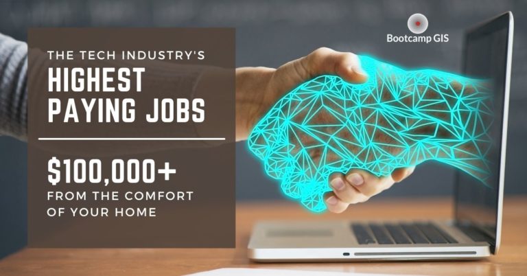
When looking at the image above, Bootcamp GIS is not only six times cheaper than a degree from a private university such as USC. Also, Bootcamp GIS enables self-paced learning on project-based courses, removing the need for commuting to attend lengthy lectures at universities. Every course at Bootcamp GIS is diligently taught by an industry practitioner presenting firsthand knowledge about their profession. Encouraging forward career planning to stay competitive and relevant for the upcoming 97 million AI jobs in the future.