How GeoAI is Revolutionizing Agriculture
GeoAI and the global food challenge
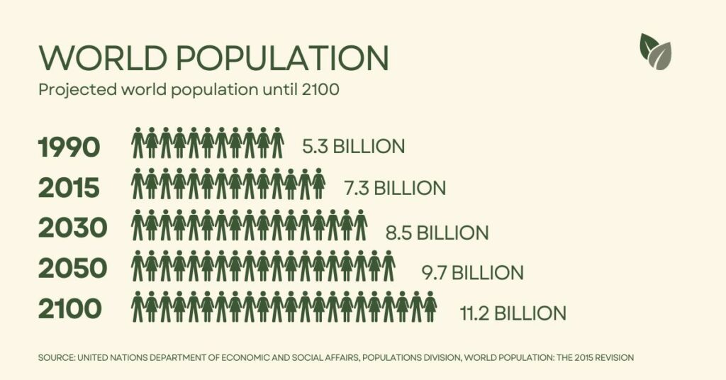
The global population has surged to over 8 billion and continues to multiply at an alarming rate. In fact, the United Nations anticipates an increase of nearly 2 billion people by 2050! One of the primary concerns associated with this rapid growth is how to meet the increasing demand for food. In response to this, geospatial artificial intelligence, or GeoAI, emerges as a powerful solution in agriculture. By utilizing innovative AI applications and predictive analysis, GeoAI is revolutionizing farming practices. This technology helps us navigate complicated issues impacting agriculture like pest management, climate change, and resource constraints. If you are interested in a career in tech and agriculture, GeoAI offers a skill opportunity where you could be addressing the critical issue of global food security.
Precision farming and data-driven decision making
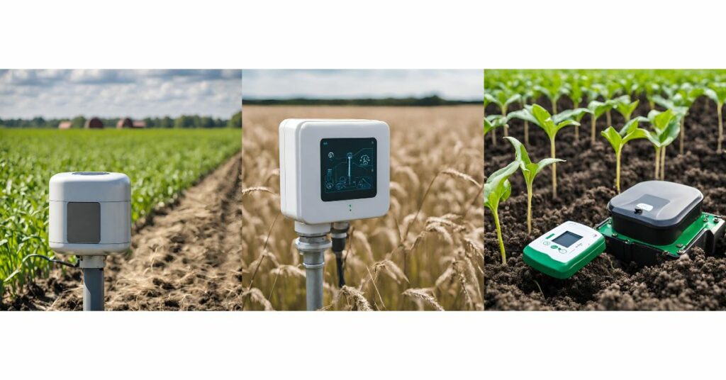
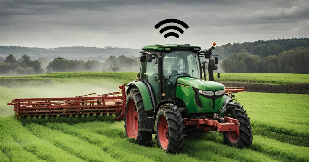
One of the incredible benefits of GeoAI is its ability to integrate advanced technologies to enable precision farming and data-driven decision making. Let’s explore a few ways farmers utilize these capabilities to increase production. Satellite imagery serves as the eyes in the sky, allowing farmers to monitor crop health, identify potential issues, and optimize field management. Drones take this a step further, offering real-time surveillance and high-resolution images for precise field-level insights. Additionally, IoT devices are able to continuously collect data on soil conditions, climate, and crop health. Together, these technologies empower farmers with real-time monitoring and crop analysis. Why is this so important? Having the most accurate and up-to-date data enables farmers to make well-informed, efficient decisions to maintain the health and productivity of their crops.
For example, GeoAI is able to detect nutrient deficiencies in soil. Farmers can use this data to make precise adjustments to their fertilization plans for healthier soil and plants. Geospatial AI is also vital in the area of pest and disease management. Imagery and sensors are able to detect early signs of trouble, allowing for early intervention which mitigates damage. Targeted pesticide application minimizes the need for broad-spectrum treatments and thereby reduces environmental impact. These are just a couple of ways GeoAI facilitates precision farming and informed decision making for crop management.
Climate-smart agriculture
Another key strength of GeoAI lies in its ability to support climate-smart agriculture. Predictive analysis of weather patterns allows farmers to anticipate and mitigate the impact of climate change on their crops. By analyzing historical and real-time weather data, farmers can anticipate changing conditions, plan planting and harvesting schedules, and implement adaptive strategies. For instance, if a farmer was aware of an impending heat wave, they could plan to increase irrigation. Conversely, if there is a cold snap approaching, they can construct row covers to protect their harvest. This weather monitoring technology acts as a practical tool, helping farmers navigate the complexities of climate change and reduce risks associated with unpredictable weather patterns.
Resource optimization
Perhaps most importantly, GeoAI excels in resource optimization – addressing the pressing need for sustainable farming practices. Through precise monitoring and data analytics, farmers can tailor their irrigation and fertilization practices, minimizing waste and maximizing efficiency. This approach not only enhances crop yields but also promotes responsible resource management, contributing to long-term environmental sustainability. As a resident of Southern California, I am intimately aware of the importance of preserving water. In times of drought, GeoAI’s precision in water management means more than just efficient farming. It’s about community resilience – ensuring that every drop counts. Smart machinery, which utilizes GeoAI and GPS technology, is another tool that aids farmers in resource optimization. This equipment can execute very precise planting and harvesting, which reduces labor costs and enhances overall operational efficiency. Thus, by incorporating geospatial AI, farmers are able to optimize resources, boost operational efficiency, and promote sustainable agriculture.
GeoAI – the future of farming
The fusion of Artificial Intelligence and GIS is paving the way for fresh opportunities in the agribusiness sector. Perhaps you have a background in computer science or environmental science and are interested in transitioning into the role of a GeoAI engineer. Now is an opportune moment to delve into this exciting field! As a GeoAI engineer, your responsibilities would encompass defining logical structures, writing GeoAI models, and analyzing geographic outputs. To acquire these necessary skills, you could go through a degree program, obtain a GIS certificate, or take a specialized course. A GIS certification stands out as a great way to learn the most up-to-date skills and technologies for a fraction of the cost and time as a college degree. The doors to GeoAI are wide open, and we invite you to schedule a complimentary career advisement with us to learn how to upskill in geospatial AI technology that holds the potential to make a lasting impact on global food security.