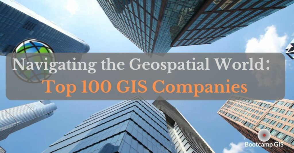
Navigating the Geospatial World: The Top 100 GIS Companies
What is a GIS?
Geographic Information Systems (GIS) has become essential as the central information hub of most data. Paper maps are a thing of the past as all of this data is tracked digitally. It is used to store, analyze, visualize, and serve spatial data. GIS technology is used across all fields such as urban planning, transportation, and environmental management. Moreover, the GIS industry is rapidly growing, and numerous companies have become national and international leaders, providing diverse GIS services. So, whether you’re new to the GIS field or an experienced professional, keep reading to discover the top companies shaping the GIS industry.
Who uses GIS?
Geographic information systems can be used to enhance decision making for any industry. In fact, nearly all companies hire people in a few different GIS Roles to improve their business. GIS is growing rapidly and will likely triple to over $200B in worldwide spend in this decade (2021-2030). Even though you may think that only geographic companies need GIS specialists, that is not the case. Nowadays, more tech companies are hiring people with a well rounded IT skill set which includes: GIS, coding, cloud, database, and data science. Here are some leading industries using GIS.
- Supply Chain Management
- Insurance
- Forestry and Timber
- Urban Planning
- Banking
- Health and Human Resources
As individuals we use locational data at our fingertips all the time now. Where is a gas station, a restaurant, or my hotel. And now the industries above are using the same data to make decisions on a large scale to track their fleet, franchises, customers, or environmental impacts.
Top 100 GIS companies
Here are 5 great companies that we sorted out according to size, impact, and future growth potential. If you are looking for a job, either as new graduates or experienced experts in the field, we hope our researched list will be helpful.
- Axim Geospatial. This company is providing solutions to help their clients solve the world’s national security, infrastructure, and environmental problems.
- Abley. They focus on developing transport strategies and infrastructure that support safer travel, improved access and mobility.
- Trimble. They have been the GPS and surveying leader for a long time focusing on developing hardware and software to collect field locational data.
- con terra. Con Terra is a company that focuses more on the IT part of GIS. It is also a platinum Esri partner, demonstrating its scale and impact.
- VertiGIS GmbH. This is an international company that acts as a supplier of GIS applications and solutions.
As we mentioned, the lesser known GIS industry is huge. Here is our Top 100 GIS companies with links to their career pages where you can look for job listings.
| Career Page | Description |
|---|---|
| Axim Geospatial | Axim Geospatial’s mission is to use our expertise to provide clarity and solutions to help our clients solve the world’s national security, infrastructure, and environmental problems. |
| Cityworks® | As the premier Web GIS-centric Platform for public asset management, Cityworks, a Trimble company, provides your organization with the tools to enhance operational intelligence and maintain a smart, safe, and resilient community. |
| con terra | By offering individual geoIT solutions, con terra GmbH support companies, organizations and institutions in digitalization – making business processes more efficient, cost-effective, transparent and user-friendly. |
| Ericsson | Ericsson is the driving force behind the Networked Society – a world leader in communications technology and services. Our long-term relationships with every major telecom operator in the world allows people, businesses and societies to fulfill their potential and create a more sustainable future. |
| Geo-Comm, Inc | GeoComm maintains a high level of collaboration with Esri and allows us to be involved with the direction for their future product development. |
| GeoDecisions | GeoDecisions is a technology solutions company. Working in data management, technology, and GIS/geospatial environments, we organize, integrate, and visualize information to prioritize collaboration and create enterprise solutions. |
| HDR | For over a century, HDR has partnered with clients to shape communities and push the boundaries of what’s possible. |
| HERE Technologies | HERE Technologies is the world’s leading location data and technology company offering a location-centric platform that is open and secure with privacy at its core. |
| Khatib & Alami | K&A is a leading Geospatial Systems Integrator and a Digital Services provider with over 500 successful projects and 34 years of experience in providing solutions and services, systems integration, and enterprise implementations. |
| Locana | Locana, a location and mapping technology company, provides software products and services that solve the world’s most pressing business, climate, and social challenges. |
| MIPMAP DMCC | MipMap Technologies globally offers spatial services on two primary fronts: setting up foundational GIS infrastructures and cutting-edge spatial technologies in its offices in the USA, the Netherlands, Turkey and Dubai. |
| Schneider Electric | Schneider Electric is a world leader in the development and implementation of Esri’s ArcGIS® software for utilities. |
| SSP Innovations | SSP Innovations is a three-time, Esri-award-winning Platinum Partner headquartered outside of Denver, with offices in CA and WI. |
| UDC | UDC is a privately held, Esri focused, spatial systems integrator primarily for Gas & Electric Utilities within the US and Canada. |
| VertiGIS | VertiGIS GmbH, Germany, is a leading supplier of geographic information systems and applications. We focus on the market segments utilities, governmental organizations, e-government applications and other selected areas of business. |
| Xylem Inc | Xylem Inc is a global team unified in a common purpose: creating advanced technology solutions to the world’s water challenges. |
| 1898 & Co. | Burns & McDonnell, headquartered in Kansas City, Mo., is a full-service engineering, architecture, construction, environmental and strategic consulting solutions firm. |
| 1Spatial | 1Spatial is a global leader in providing Location Master Data Management (LMDM) software, solutions and business applications, primarily to the Government, Utilities, Transport and Building &Construction sectors. |
| 3 GIS LLC | 3-GIS is leading the future of Geospatial Innovation by developing smart, simple, fast and surprisingly affordable GIS solutions. |
| Accenture LLP | Accenture is a leading global professional services company, providing a broad range of services and solutions in strategy, consulting, digital, technology and operations. |
| AccuWeather Enterprise Solutions | For businesses, government agencies, media, and institutions around the world, AccuWeather Enterprise Solutions delivers mission-critical, weather-driven solutions that help protect people, property and profits from the effects of weather. |
| ALKAN Communications & Information | The company provides state of the art technologies and turnkey solutions to clients across the MEA region that fully support their business needs from planning right through full operation, our methodology is to work hand in hand with our clients in all sectors and support their business needs from inception to completion |
| ARC-GREENLAB | The ARC-GREENLAB GmbH is an interdisciplinary service and software company with a focus on surveying, network documentation, geographic information systems (GIS), building information modeling (BIM) as well as forestry and the environment. |
| Atos Information Technology | Atos is the global leader in secure and decarbonized digital with a range of market-leading digital solutions along with consultancy services, digital security and decarbonization offerings; an end-to-end partnership approach. |
| Avineon, Inc. | An SEI-CMMI Maturity Level 3 and ISO 9001:2015 registered firm founded in 1992, Avineon, Inc. (Avineon) specializes in delivering information technology, geospatial, and engineering support services. |
| Bartlett & West Inc | Bartlett & West’s portfolio of professional services—from engineering to landscape architecture, from GIS to information management, from field services to sustainable development—delivers solutions to our clients’ challenges. |
| Bayanat for Mapping & Surveying Services LLC | Bayanat, a G42 company with 40 years of heritage, provides comprehensive world-class AI-powered geospatial intelligence to a growing number of sectors such as Defense, Environment, Energy & Resources, Smart Cities and Transportation. |
| Blue Raster LLC | Blue Raster provides dynamic web and mapping solutions that help clients use the power of GIS to achieve their missions. |
| Bradshaw Consulting Services, Inc. | Located in scenic Aiken, South Carolina, Bradshaw Consulting Services, Inc., an Esri Gold Tier Partner is a privately held, woman-owned company. Our winning team encompasses some of the best and brightest players from the information technology, application development and GIS communities. |
| BTC Business Technology Consulting AG | We are one of Germany’s leading IT consulting companies. Our consultants are passionate about technology, processes and digitalization. |
| Cartegraph | Cartegraph builds safer, more resilient and sustainable communities through better stewardship of buildings and infrastructure. |
| CDM Smith Inc. | CDM Smith provides lasting and integrated solutions in water, environment, transportation, energy and facilities to public and private clients worldwide. |
| CentralSquare Technologies | CentralSquare Technologies is the largest independent public sector software provider that powers all aspects of managing local government to build smarter and safer communities. |
| CHA Integrated Solutions | CHA Integrated Solutions (formerly Novara GeoSolutions) is an innovative consulting, technical services, and geospatial-based software firm. |
| Clearion Software, LLC | Clearion is a leading provider of software solutions designed to modernize field operations for safe, reliable, and sustainable infrastructure. |
| Clevest | Winner of the Esri Best Mobile App award, Clevest provides software for mobile workforce management and smart grid operations exclusively for electric, gas and water utilities and municipalities. |
| CyberTech Systems and Software Inc | CyberTech is an expert at delivering large and complex geospatial products, solutions and custom projects. We are a specialist in the full suite of GIS technologies, “ArcGIS Services by ArcGIS Experts” and the transformation to the Esri Geospatial cloud. |
| Cyclomedia Techonology | Cyclomedia Technology provides a cloud-based solution for street-level imagery used by government agencies and private companies for asset management. |
| Cyient | Cyient are a global engineering and services company certified at level 5 of CMMI-DEV 2, with over 25 years of Esri partnership and over 15000 employees around the world. |
| Dar Al Handasah – Shair & Partners | Established in 1956, Dar Al-Handasah Consultants (Shair and Partners) is one of the world’s leading and largest international consultancies specializing in engineering, architecture, planning, environment, project management and economics. |
| Data Transfer Solutions LLC | Enabling Data, Empowering People. Headquartered in Orlando, Florida, DTS is a leader in GIS-based asset management and transportation planning. |
| Davis Demographics MGT LLC | Davis Demographics MGT provides comprehensive and accurate education planning services including student forecasting and boundary planning software and services. |
| Dewberry | Dewberry is a leading, market-facing firm with a proven history of providing professional services to a wide variety of public – and private-sector clients. |
| EagleView Technologies, Inc. | EagleView (formerly Pictometry) provides high-resolution geo-referenced aerial imagery through its patented image capture system and user-friendly CONNECTExplorer interface for local and regional governments worldwide. |
| Enghouse Systems Limited | Since 1984, Enghouse has carried out pioneer work in the field of spatial intelligence and currently develops geospatial network design and management solutions for the telecommunications, transportation and pipeline industries. |
| TAGNIA Services | TAQNIA Services incorporated as Engineering and Technology Services Company (TAQNIA SERVICES), is a professional services organization |
| England-Thims & Miller, Inc. | England-Thims & Miller, Inc. (ETM) was founded in Northeast Florida with the aim of guiding municipal, commercial, and land development throughout the region. |
| ENTRUST Solutions Group | G2 Integrated Solutions provides a Pipeline Operations Platform that extends the Esri® Platform to empower users to integrate and extend a fully functional pipeline management solution. |
| Eos Positioning Systems Inc | Eos Positioning Systems, Inc., (Eos) specializes in the design and manufacture of high-accuracy GPS / GNSS receivers for GIS professionals performing mapping and surveying in the field. |
| Epoch Solutions Group LLC | Epoch Solutions Group is a leading provider in modernizing a utility’s field workforce. The overall driving vision of a single application for all field workflows coupled with geospatially enabled back-office scheduling, work type authoring, work order creation applications, and data synchronization is delivered through the EpochField and EpochSync Platforms. |
| EPTISA TI | Eptisa TI has acquired a strong experience in applied technologies, dedicated to providing consultancy and solution development/implementation for a wide range of areas. |
| Exprodat | Transform your company performance by putting Exprodat’s unique ArcGIS Platform solutions at the heart of your Energy projects; enabling your users with enhanced integration, analysis and results sharing applications. |
| Frontier Precision Inc | Frontier Precision has a passion for helping others utilize and integrate location technology to better understand the world around them. |
| Futura Systems, Inc. | Futura Systems provides enterprise utility GIS solutions to hundreds of electric membership cooperatives, electric municipal systems, and other utility providers across the United States. |
| GEO Jobe GIS Consulting | GEO Jobe is a multi-award winning long standing Esri cornerstone partner founded over twenty years ago in 1999. We provide geospatial solutions and services to over 9,000 organizations globally (52% US / 48% international). |
| GeoDyn | GeoDyn provides fast automated scanning and georeferencing of aerial film archives to provide access to the wealth of temporal information contained in the many millions of aerial photographs still locked away in the archives of Governmental and Public Organizations worldwide. |
| GEOGRAPH Technologies LLC | Fiber optic network building is tough business — and we get it. We’ve been there, and we know exactly what you’re dealing with. |
| Geographic Business Solutions Ltd. | Geographic Business Solutions (GBS) specialises in developing custom Esri enterprise solutions. We have a highly experienced team of GIS professionals including GIS software developers, solution architects, business analysis, project managers and consultants. |
| geoSpatial Innovations Inc | Engineered Simplicity. Better Workflow. GeoSpatial Innovations, Inc (GSI) delivers industry-leading software to improve productivity and safety for workers engaged in natural gas & electric design and optimization, vegetation management, and GIS implementation services. |
| Houseal Lavigne Associates | Houseal Lavigne Associates is an award winning geodesign consulting firm specializing in all areas of community planning, economic development and urban design, with expertise in comprehensive planning, corridor planning, downtown planning, neighborhood planning, zoning, market analysis, project implementation and financing, and citizen engagement. |
| ICA Ingenieros Consultores Asociados | ICA is an Uruguayan company created to provide high level development and specialized geoinformation technology solutions, to private and public organizations, from its beginning ICA aimed to integrate heterogeneous information and to develop ultimate technology systems. |
| Idox plc | Our specialist software solutions power the performance of government and industry, driving productivity and a better experience for everyone. |
| IHS Markit | IHS Markit is a global information company with world-class experts in the pivotal areas shaping today’s business landscape including oil and gas; product design; supply chain intelligence; sustainability, risk and compliance; and industry analysis, strategy and planning. |
| Innovate!, Inc. | Founded in 2002, Innovate! Inc. (Innovate) is a small, woman-and-minority business that delivers specialized geospatial for Federal, State, Local, Tribal, and Non-Profit organizations. |
| Intrado Safety Services | For more than 40 years, Intrado has maintained a focus and passion for saving lives and supporting the needs of public safety. |
| IP SYSCON GmbH | IP SYSCON GmbH is a software and system vendor for 20 years now, working in the field of (geo)graphical information systems for customers from public authorities as well as the private sector |
| L3Harris Technologies | L3Harris provides ArcGIS users with analytics, insights, and answers you can trust. |
| Leica Geosystems | A global company supporting measurement professionals worldwide. Revolutionising the world of measurement and survey for 200 years, Leica Geosystems, part of Hexagon, creates complete solutions for professionals across the planet. |
| Leidos Inc | The foundation of the Leidos culture is our Values, Beliefs and Expectations by which we select, recognize and reward employees. They create the environment that drives us toward our mission. |
| Magnolia River Services Inc. | Magnolia River Services, Inc. (Magnolia River) is a client-focused and solution-oriented company that specializes in engineering, inspection, GIS, and software solutions for utility infrastructure and operations. |
| Maxar | Maxar is a leading space technology and intelligence company. We unlock the promise of space to help governments and businesses solve problems on Earth and beyond. |
| MOTOROLA SOLUTIONS INC | At Motorola Solutions, we not only build that lifeline – with mission-critical services, software, video and analytics, backed by secure, resilient land mobile radio communications – we advance it every day through our commitment to innovation. |
| National Information Solutions Cooperati | NISC, a leading provider of information technology products and services, offers integrated software and hardware solutions to utilities and telecommunications companies as well as other infrastructure industries and Fortune 100 and 500 businesses. |
| nearmap | Nearmap provides easy, instant access to high-resolution aerial imagery and geospatial tools, including: • Current and historical vertical, oblique, and panoramic imagery • On demand, city-scale 3D datasets • Verified, pre-processed insights with Nearmap AI |
| New Century Software by MISTRAS | New Century Software by MISTRAS, is a leading provider of pipeline integrity management software and services to energy transportation companies. |
| Nexiga | As one of the market leader in Location Intelligence and geomarketing, one of our primary goals is to describe markets, areas and target groups throughout Germany, accurate to house level and true to reality. |
| NSGIS (NorthSouth GIS LLC) | Founded in 2005, NSGIS (NorthSouth GIS LLC) is a US-based, client-focused, geospatial systems integrator and the developer of ArcGIS-based Enesgy® Lease Manager and Enesgy Documents software. |
| NV5 Geospatial | NV5 Geospatial (formerly Quantum Spatial, Inc.) is the geospatial pioneer pushing the boundaries of data and analytics to deliver actionable solutions to transform the way our clients utilize and value geospatial data. |
| Pandell Technology Corporation | Pandell Technology Corporation, an Esri Gold Business Partner for over 20 years, provides software and services utilizing the Esri® ArcGIS®. |
| POWER Engineers Inc | POWER is a full-service global consulting and engineering firm specializing in integration and progressive solutions for utilities, energy, facilities, communications, environmental, food and beverage and Federal markets. |
| Pro-West & Associates, Inc. | A 30-year Esri Gold Business Partner, Pro-West provides GIS consulting, data services, application development, solution configuration, integration and system architecture services to government and commercial organizations. |
| Quiet Professionals LLC | STRATEGIC GLOBAL SOLUTIONS FOR A COMPLEX WORLD Core Competencies: Operational Mission Support, Cloud Managed Services, C3I – Geospatial Services, Intelligence Support, DevSecOps, AI/ML and Information Technology Support. |
| R&K Solutions, Inc. | R&K Solutions specializes in services and solutions which empower clients to strategically manage real property assets in alignment with their business and mission goals. |
| RAMTeCH Software Solutions, Inc. | RAMTeCH Software Solutions, Inc. is a global leader in spatial enterprise solutions and engineering services for utility, telecommunication, government and infrastructure organizations. |
| ROK Technologies, LLC | At ROK Technologies, our sole focus is to architect, deploy and manage the ArcGIS® Enterprise suite and Desktop applications in Cloud and Hybrid environments. |
| RouteSmart Technologies INC | RouteSmart Technologies, Inc. is the leading provider of route optimization software and logistics professional services for the newspaper, postal/local delivery, public works and utility industries. |
| Sidwell | With over 90 years of experience, Sidwell is an industry-leading geospatial solutions provider specializing in GIS products, services, and solutions focused on the diverse needs of government and private industries. |
| Siemens AG | Siemens AG is a technology company focused on industry, infrastructure, transport, and healthcare. From more resource-efficient factories, resilient supply chains, and smarter buildings and grids, to cleaner and more comfortable transportation as well as advanced healthcare, the company creates technology with purpose adding real value for customers. |
| SIMILIX ApS | Similix provides technological expertise to the global utility sector through our consultancy services and through our products. |
| Spatial Business Systems (SBS) | SBS is the leading provider of integrated design solutions for the utility industry. SBS products include Automated Utility Design, Substation Design Suite™ and Utility DataHub™. |
| Spatialitics | Spatialitics™ is a SaaS-based products company that allows organizations to unleash the power of spatial analytics. It develops transformative spatial platform products – by unifying location intelligence with enterprise data to deliver industry specific solutions with zero footprint. |
| Sweco Nederland B.V. | Sweco is a leading sustainable design and management consultancy active in four business lines: Planning & Design, Transportation & Mobility, Water & Energy, Monitoring & Testing. |
| SWORD | Created in November 2000, Sword is a specialized IT services company with a current headcount of 1 300 staff based in 14 contries. |
| Symology Ltd. | Symology is the UK’s largest and most successful provider of Street Works Management solutions and is a leading supplier of integrated Highway Asset Management solutions. |
| Telefonica Soluciones | Telefónica, as a global service and communications operator and as an emergency system integrator with implementation experience dating back to 1995, has got a complete vision of the emergency process, from the service user to resource management. |
| Tensing International B.V. | Tensing is a recognized expert in solving GIS and ETL challenges worldwide through innovative enterprise solutions. |
| Timmons Group | Timmons Group‘s mission is to achieve unparalleled understanding of our clients, their businesses and their visions resulting in unrivaled customer service and shared success. |
| Topomat | Topomat is an IT services company specializing in Geographic Information Systems (GIS). Gold Partner Esri, Topomat integrates and develops GIS solutions based on all Esri products. |
| Trabajos Catastrales SA | TRACASA is a government owned company, from the Navarre Autonomous Region of Spain. Owned by the Government of Navarre. |
| Trimble Forestry | Our CONNECTED FOREST™ solutions are designed to improve productivity and streamline all forestry operations. |
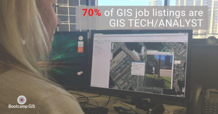
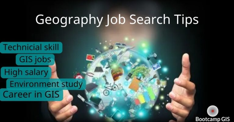
Preparing to get a GIS job
Want to get into these companies and start your career as a GIS specialist? Take a look at our GIS Jobs Report to see what technologies and what roles are being hired in which locations. Many new college graduates are getting exposed to standard ‘Intro to GIS’ or ‘Intro to Spatial Analysis’ courses. But the job seekers can quickly become more competitive if you enhance your GIS portfolio with these skills.
- Database and SQL queries
- Cloud architecture
- Python scripting
- Data science
- UAV piloting and data processing
It’s okay if you don’t have a geography degree. Many people have a background in some discipline but want to know how to map the type of data they are interested in. See the Top Rated GIS Certificate programs to pick one that is right for you. You can earn a GIS certificate in 6-12 months, but be sure to assess the curriculum to look for the most applied GIS courses. This will make you more qualified to earn the best GIS salaries. If you’d like more advice about the GIS career path, book a career advisory session with us to get some industry insights and talk about your plan!